
One bus, actual GPS trace, coloured by elapsed time
#1,798 opened on Aug 1, 2026
Repository metrics
- Stars
- (95 stars)
- PR merge metrics
- (PR metrics pending)
Description
⚠️ AI-generated draft — needs human validation
This issue was written by an AI agent from materials produced during the hasadna Open Bus hackathon (July 2026). The underlying analysis was built fast, under hackathon conditions, and has not been peer-reviewed. Figures, endpoint behaviour and conclusions all need independent verification before anyone acts on them or quotes them publicly.
Please validate before implementing. Corrections very welcome.
What it answers
A single real ride's raw GPS trail on a map, coloured by elapsed time. It makes no analytical claim — its job is ground truth for the eye. Every other card turns pings into statistics; this shows what the pings actually look like, including the reporting interval, the dropouts, and the clustering when a bus sits still.
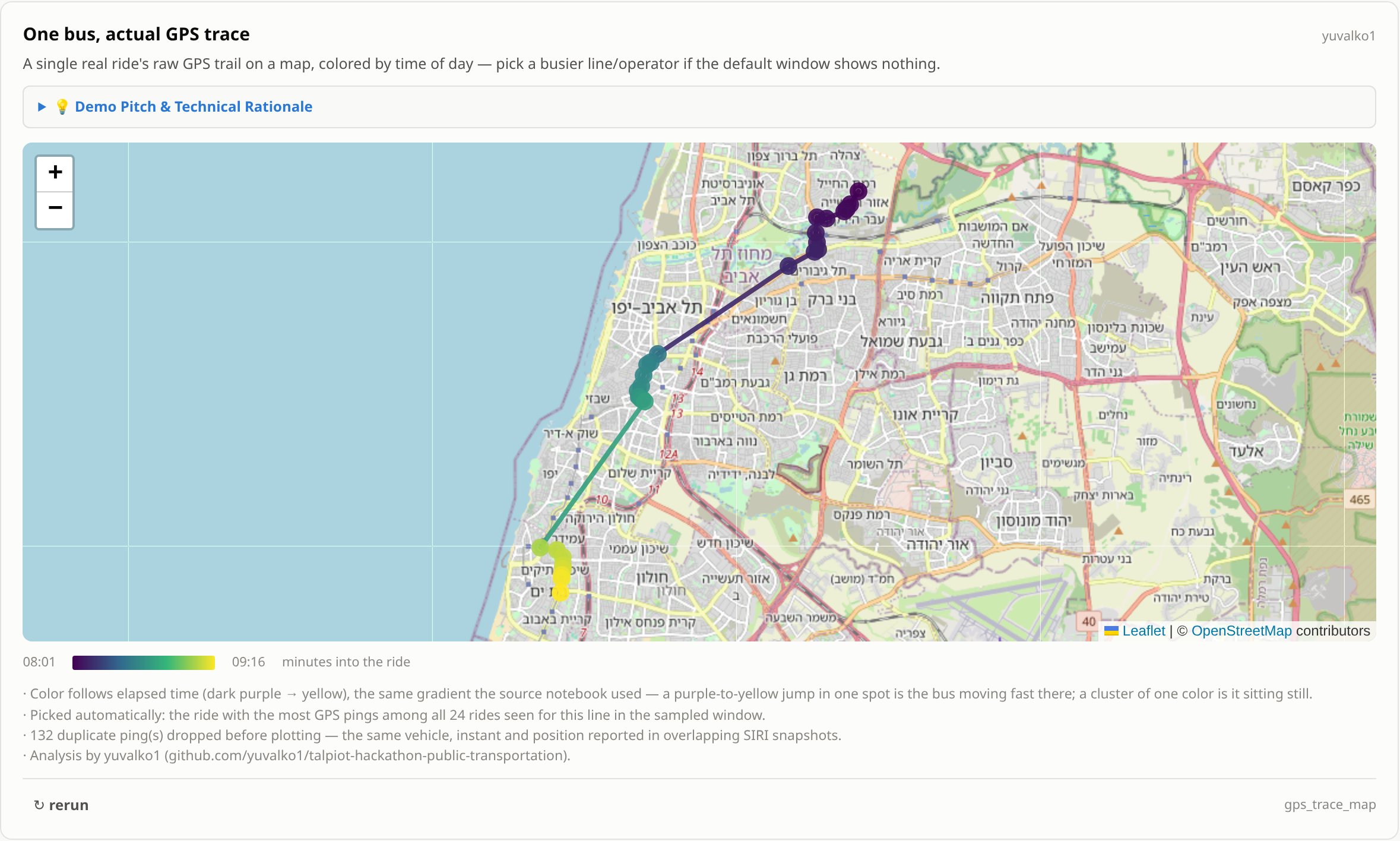
One bus, actual GPS trace, coloured by elapsed time — screenshot of the hackathon dashboard card.
How it works
- Resolve the line to a
line_refbefore fetching (theroute_short_namefilter is silently ignored by this endpoint — see the separate bug in this milestone). - Fetch a 4-hour weekday morning window; deduplicate pings.
- Pick the ride with the most pings.
- Draw one coloured segment per consecutive pair, plus a point per ping with its timestamp, along a viridis gradient.
Where it could go in דאטאבוס
/vehicle — that page is already about a single vehicle's journey.
A suggestion, not a decision — page ownership is the maintainers'.
Known limitations
One ride, one morning, chosen for being the best-tracked — which for a card about feed quality shows the feed at its best. Nothing generalises from it. The colour gradient is normalised per ride, so two loads are not comparable.
Suggested next steps
Offer the median or worst-tracked ride as well as the best — that is far more informative about what the data usually looks like, and costs nothing to add.
Status
The research is done and the numbers exist — a working implementation runs in the hackathon repo against the live Stride API. What is missing is a production-shaped version in this app.
Credit & provenance
Found during the hasadna Open Bus hackathon, July 2026 — analysis by yuvalko1.
· Method, evidence and caveats: algorithms/gps-trace-map.md
· Original work: https://github.com/yuvalko1/talpiot-hackathon-public-transportation (private repo — ask the owner for access)
· Issue drafts and the full defect list: algorithms/upstream-issues.md